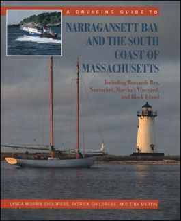
A Cruising Guide to Narragansett Bay and the South Coast of Massachusetts: Including Buzzard's Bay, Nantucket, Martha's Vineyard, and Block Island
Receive via shipping:
- Print bound version of the complete text
Preface to Narragansett Bay
Preface to the South Coast of Massachusetts
How to Use This Book
Part One Narragansett Bay
Background on the Bay
The Lower Bay, with Block Island
The Middle Bay
The Upper Bay, Including Mount Hope Bay
The Sakonnet River and Aquidneck Island South Coast
Part Two The South Coast of Massachusetts
Background on the South Coast
The Southeast Corner
Buzzards Bay
Woods Hole and Hadley Harbor
The South Cape
Nantucket
Martha's Vineyard
The Elizabeth Islands
Part Three Matters of Interest
More About Narragansett Bay
More About the South Coast of Massachusetts
Appendices
Appendix One Cookery
Appendix Two Further Reading
Appendix Three Marina Listings and Mooring Services
Appendix Four Launch Ramps on Narragansett Bay
Appendix Five Launch Ramps on the South Coast of Massachusetts
Appendix Six Some Cruise Suggestions for Narragansett Bay
Appendix Seven Chambers of Commerce and Other Resources for the South Coast of Massachusetts
Appendix Eight Harbormasters on the South Coast of Massachusetts
Appendix Nine Tidal Current Charts
Aerial Photograph of Narragansett Bay
Index
Between Long Island Sound and the elbow of Cape Cod lies a richly varied cruising ground. A Cruising Guide to Narragansett Bay and the South Coast of Massachusetts is the definitive cruising guide to these waters. Its coverage extends to the headwaters of Narragansett Bay and miles offshore to the solitude of Block Island and Nantucket.
Longtime area boaters Lynda and Patrick Childress and Tink Martin take you on a personal tour with all you need for a day, a weekend, or several weeks of cruising. They provide essential information on weather, tides, currents, and pilotage, as well as the availability of moorings and the closest place to pick up provisions. The unique harbor rating system shows at a glance what each anchorage offers in facilities, protection, beauty, and interest. Maps and charts help negotiate tricky channels or find that hidden marina.
When you've dropped anchor and are sitting back in the cockpit after a day's cruising, the guide continues to inform you, pointing out places to go for food and entertainment, where to find hiking trails, picnic and fishing spots, wildlife sanctuaries, museums, and more. In addition, the authors give cruisers the historical context in which to view the passing scenery, and they impart a deep affection for the region's unique character.